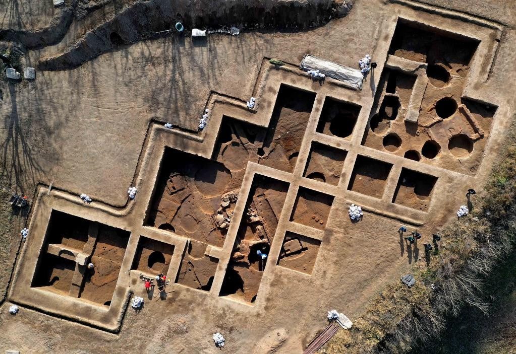
Archaeological Landscape Mapping

We provide non-invasive, high-resolution recording of archaeological landscapes for commercial archaeology units, heritage consultancies, and academic researchers. Our work supports pre-determination surveys ahead of development, condition recording of scheduled monuments, and detailed analysis of earthworks for research and management purposes.

The DJI Matrice 300 RTK paired with the Zenmuse L2 LiDAR sensor (hired in for archaeological projects) captures multi-return point clouds that allow filtering of vegetation returns to model the bare-earth surface beneath. This is particularly valuable for woodland and pasture sites where ridge-and-furrow, lynchets, deserted medieval villages, and other low-relief features are obscured from conventional aerial photography. For open sites and detailed feature recording, the Matrice 4 Enterprise provides high-resolution photogrammetric capture for textured 3D models and orthomosaics.

All deliverables are georeferenced using Ordnance Survey datums and integrate directly into standard GIS workflows. We work in line with Historic England guidance and CIfA standards for digital recording.

Technical Specifications:

  • Primary Airframes: DJI Matrice 300 RTK (LiDAR work) / DJI Matrice 4 Enterprise (photogrammetric capture)

  • Sensor / Payload: Zenmuse L2 multi-return LiDAR with co-registered 20 MP RGB (hired in); M4E 4/3 CMOS wide-angle with mechanical shutter for distortion-free mapping

  • Positioning: Integrated RTK with Emlid Reach RS4 GNSS base station (hired in) for sub-5 cm absolute accuracy

  • Technical Advantage: Up to five returns per laser pulse allows accurate bare-earth modelling beneath dense canopy, revealing features invisible to standard aerial photography

  • Coordinate Reference: OSGB36 / OSTN15 with ODN heights via OSGM15, or client-specified CRS

  • Deliverables: Classified point clouds (.LAS / .LAZ), bare-earth Digital Terrain Models, Digital Surface Models, georeferenced orthomosaics (.TIF), 3D textured meshes (.OBJ), and derived visualisations including hillshade, slope, and Local Relief Models for feature identification

Previous
Previous

Industrial Roof & Asset Inspection